GPS - It Isn't The Satellites
That know Where You Are
Richard Cheshire,
SpaceLaunchInfo.Com
- GPS - What is it?
- Global Positioning System - Satellites are seperate
- Space Segment
- Control Segment
- User Segment
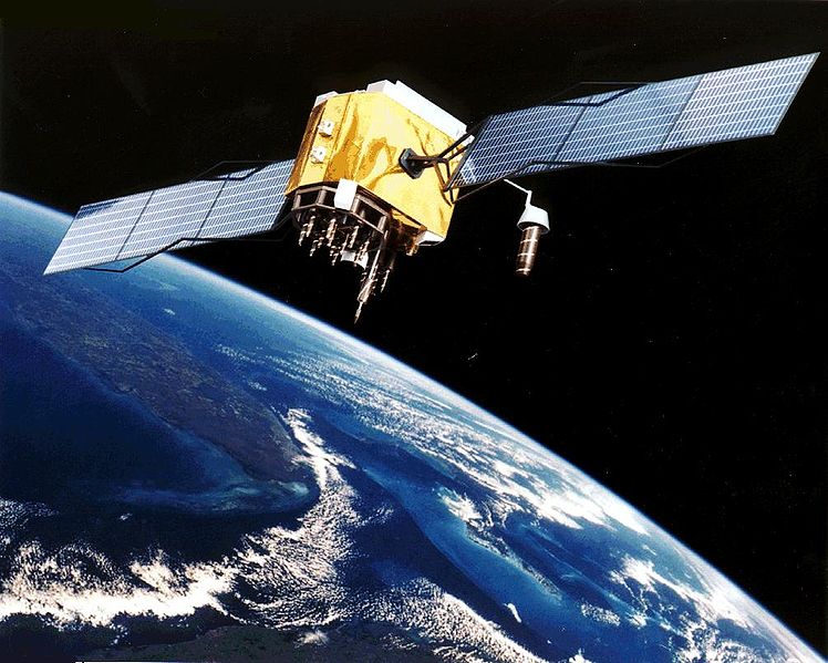
 The GPS consists of three parts: the space segment, the control segment, and the user segment. The U.S. Air Force develops, maintains, and operates the space and control segments. GPS satellites broadcast signals from space, which each GPS receiver uses to calculate its three-dimensional location (latitude, longitude, and altitude) plus the current time.
The space segment is composed of 24 to 31 satellites in medium Earth orbit and also includes the boosters required to launch them into orbit. The control segment is composed of a master control station, an alternate master control station, and a host of dedicated and shared ground antennas and monitor stations. The user segment is composed of hundreds of thousands of U.S. and allied military users of the secure GPS Precise Positioning Service, and tens of millions of civil, commercial, and scientific users of the Standard Positioning Service (see GPS navigation devices).
The GPS consists of three parts: the space segment, the control segment, and the user segment. The U.S. Air Force develops, maintains, and operates the space and control segments. GPS satellites broadcast signals from space, which each GPS receiver uses to calculate its three-dimensional location (latitude, longitude, and altitude) plus the current time.
The space segment is composed of 24 to 31 satellites in medium Earth orbit and also includes the boosters required to launch them into orbit. The control segment is composed of a master control station, an alternate master control station, and a host of dedicated and shared ground antennas and monitor stations. The user segment is composed of hundreds of thousands of U.S. and allied military users of the secure GPS Precise Positioning Service, and tens of millions of civil, commercial, and scientific users of the Standard Positioning Service (see GPS navigation devices).
How GPS Works
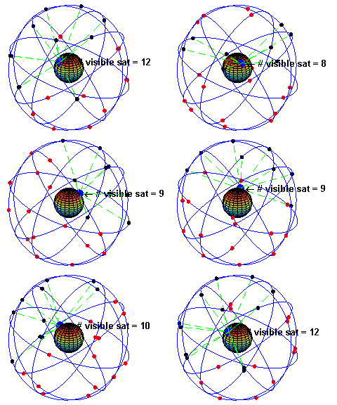 A GPS receiver calculates its position by precisely timing the signals sent by the GPS satellites high above the Earth. Each satellite continually transmits messages which include
- the time the message was transmitted
- precise orbital information (the ephemeris)
- the general system health and rough orbits of all GPS satellites (the almanac).
The receiver utilizes the messages it receives to determine the transit time of each message and computes the distances to each satellite. These distances along with the satellites' locations are used with the possible aid of trilateration, depending on which algorithm is used, to compute the position of the receiver. This position is then displayed, perhaps with a moving map display or latitude and longitude; elevation information may be included. Many GPS units show derived information such as direction and speed, calculated from position changes.
Three satellites might seem enough to solve for position, since space has three dimensions and a position near the Earth's surface can be assumed. However, even a very small clock error multiplied by the very large speed of light[26]—the speed at which satellite signals propagate—results in a large positional error. Therefore receivers use four or more satellites to solve for the receiver's location and time. The very accurately computed time is effectively hidden by most GPS applications, which use only the location. A few specialized GPS applications do however use the time; these include time transfer, traffic signal timing, and synchronization of cell phone base stations.
Although four satellites are required for normal operation, fewer apply in special cases. If one variable is already known, a receiver can determine its position using only three satellites. (For example, a ship or plane may have known elevation.) Some GPS receivers may use additional clues or assumptions (such as reusing the last known altitude, dead reckoning, inertial navigation, or including information from the vehicle computer) to give a less accurate (degraded) position when fewer than four satellites are visible.
Notes From The Talk
- Orbitron Satellite tracking Software
- Air Force GPS Fact Sheet
- US Naval Observatory GPS Time Page
About RTG's (Radioisotope Thermoelectric Generators)
NASA